FireTowers
Adventure Weekends to the Catskill Fire Towers
Looking for new adventures for your Troop? Consider the Fire Towers in the Catskill Mountains.
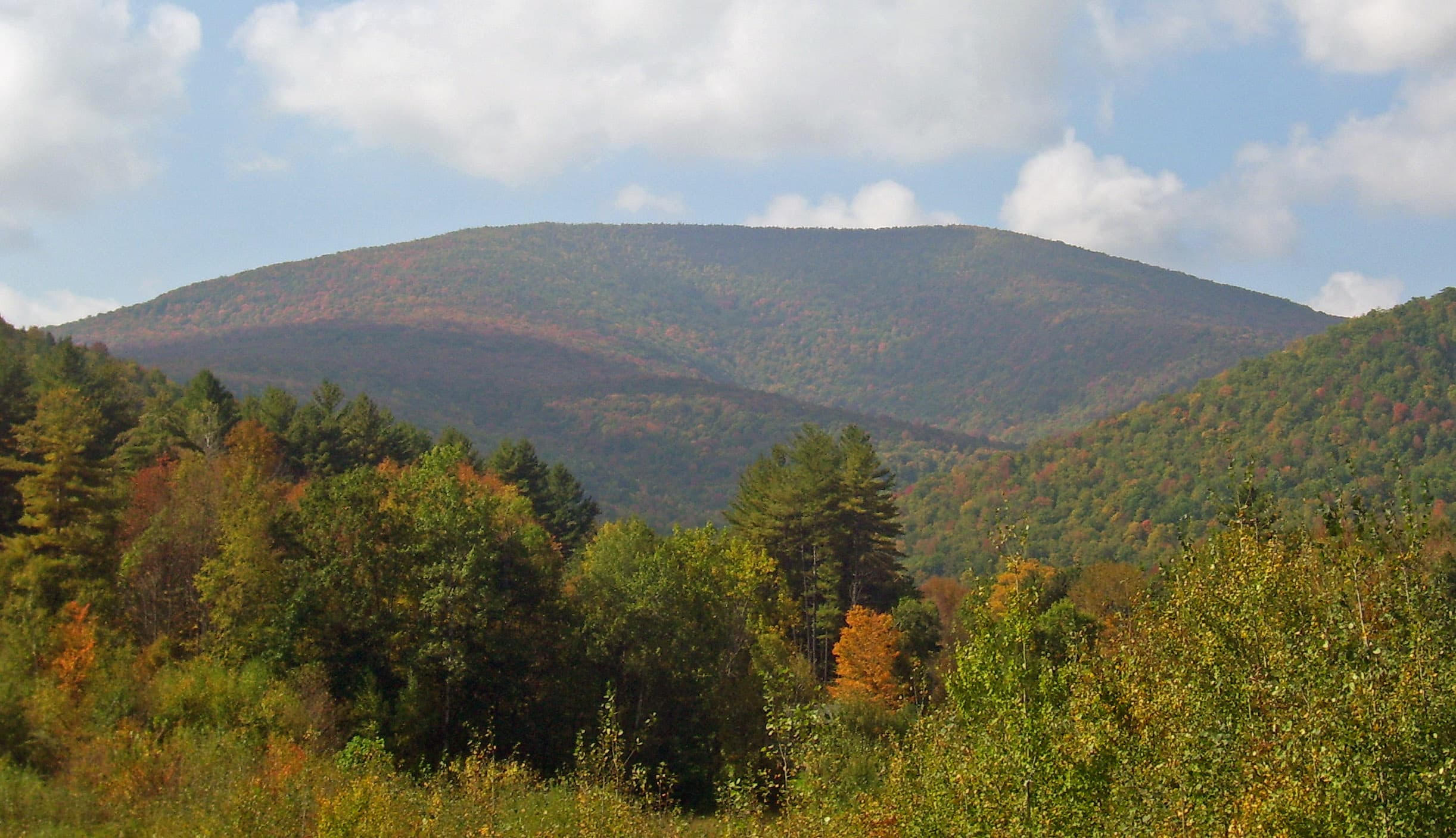
There are few places in the Catskills with better views than those from the 5 fire towers in the Catskills. And with some planning, it is possible to get in 2 towers over a 3-day weekend, so here are some possibilities.
Basically, to hit at least two towers over a long weekend requires leaving early Saturday morning and heading to one of the towers before going to Onteora. Then, on Sunday, it is an easy drive to the Balsam Fire Tower for a great day out, lunch on the mountain and back to camp for dinner. It's then home on Sunday.
That said, there are some state campgrounds, and some private ones, that you may also want to consider. But that said, be sure and read the regulations because there are limitations on the number of tents and campers for each site, so it may require reserving multiple sites. A list of state campgrounds is at the end of this Fire Tower list and a google search will provide locations for some of the private campgrounds, which usually starts getting a bit more expensive.
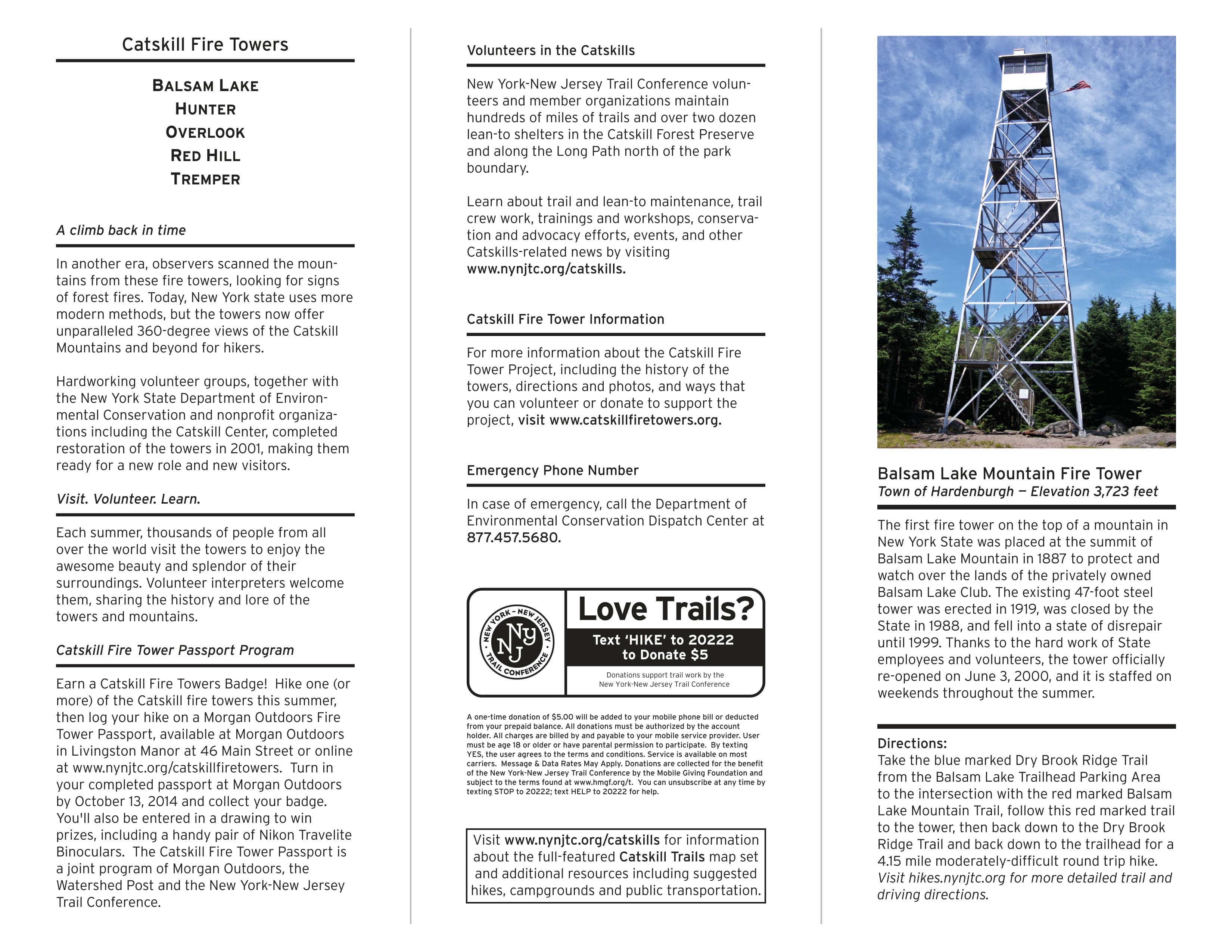
There is also a list below of other websites with information about the Fire Towers…and should you get hooked, the Fire Tower Challenge. And as always, the Red Trail Wanderers are here to answer any questions. Feel free to email James Van Tassell at jvantassell@osrtrails.org
Fire Tower Adventures
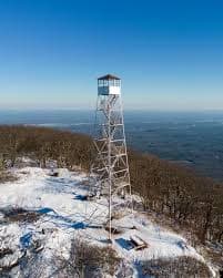
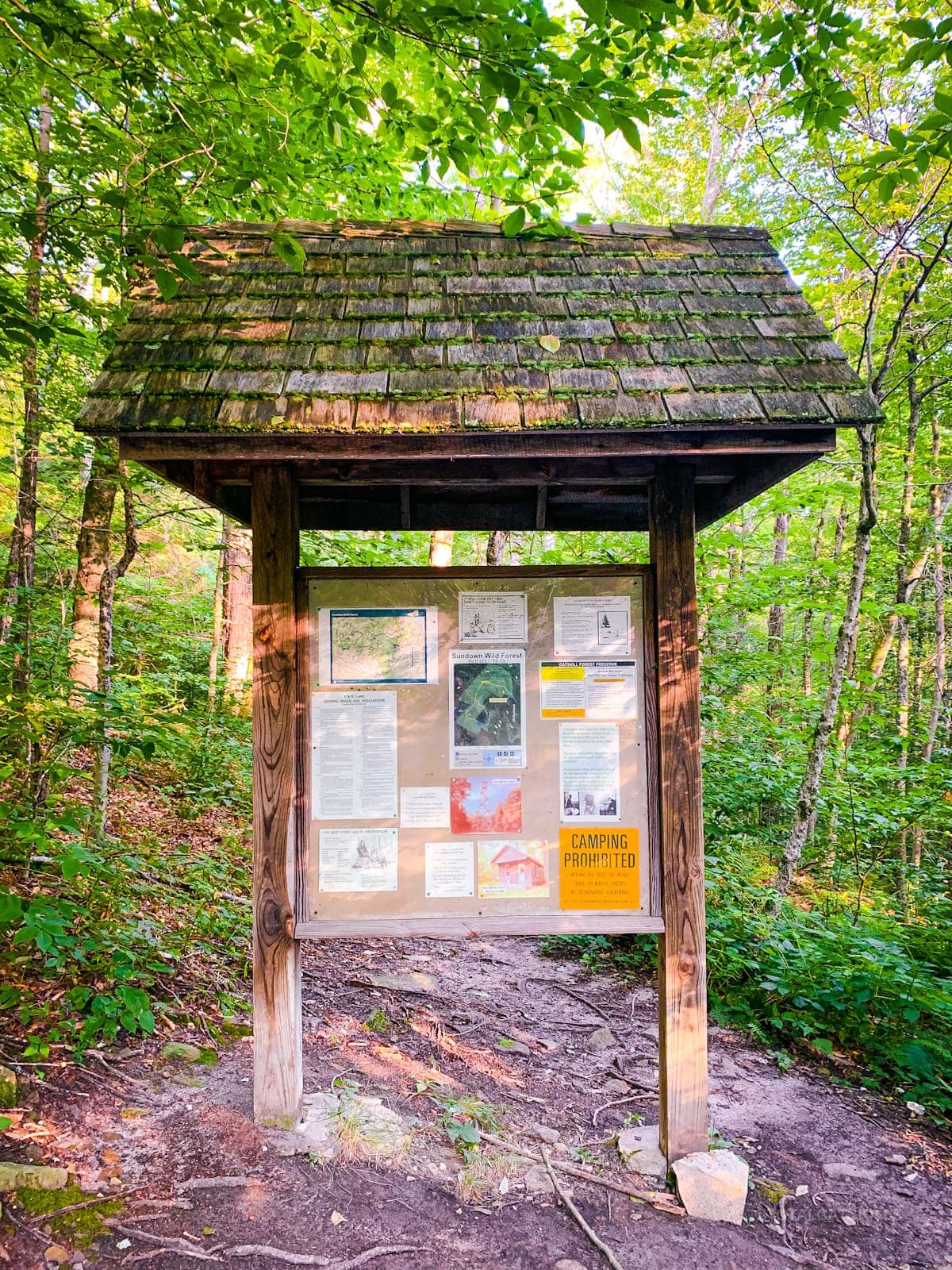
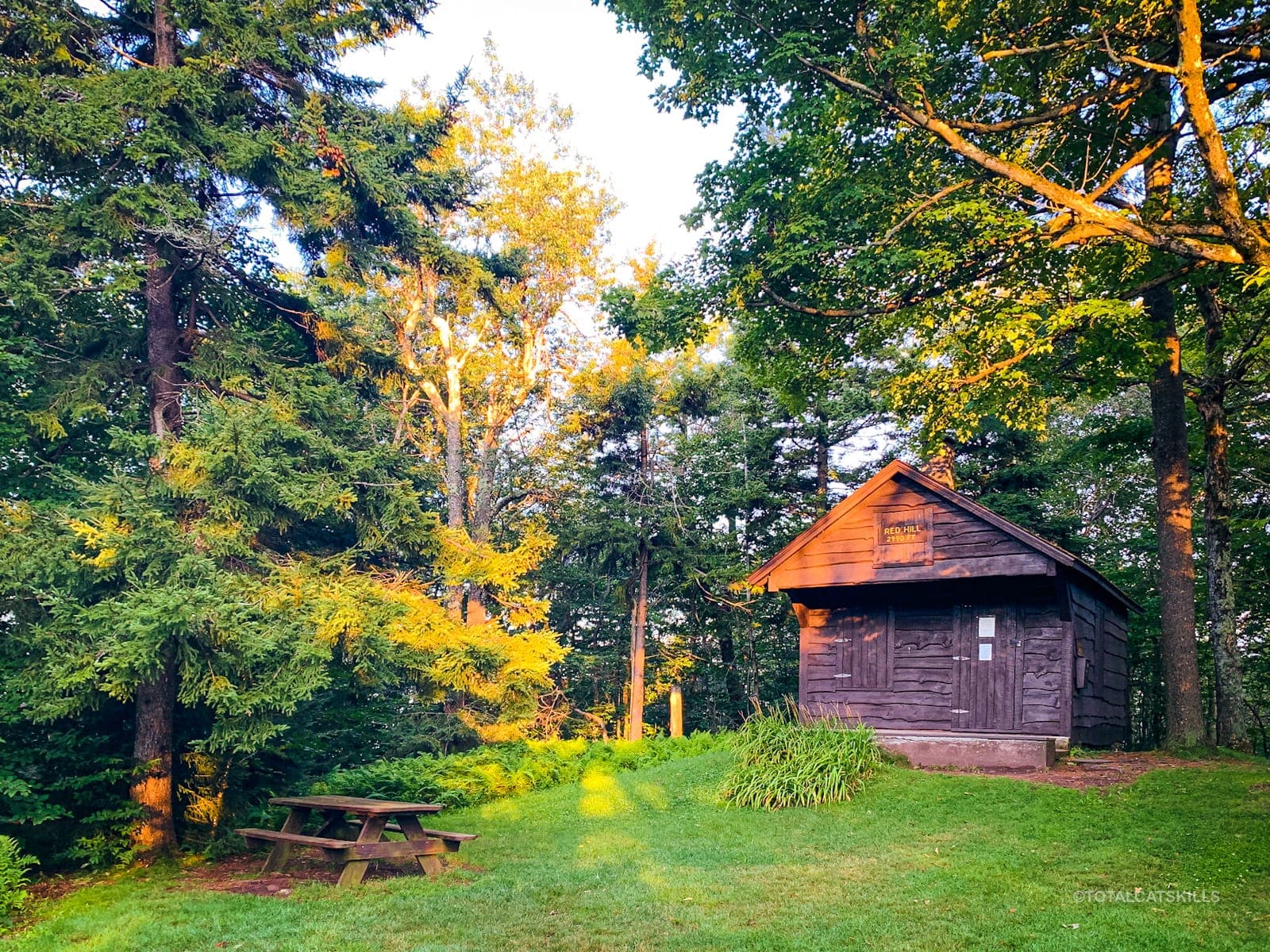
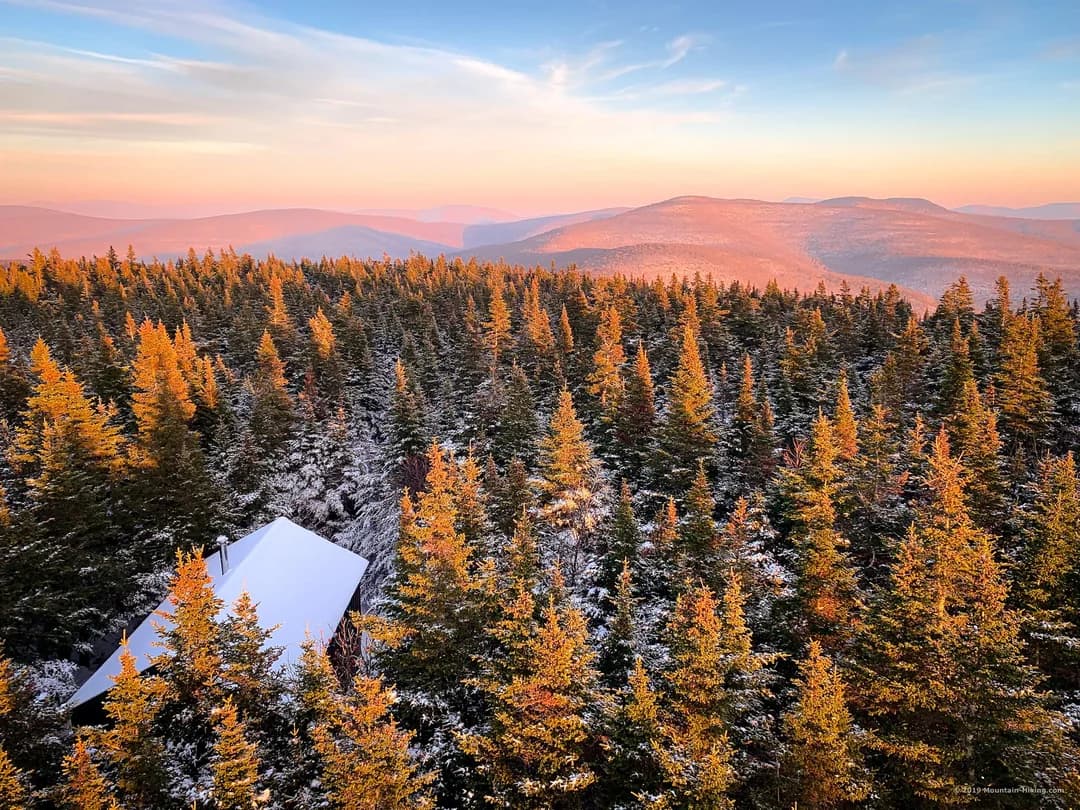
Red Hill Fire Tower - The easiest of the five towers to hike
Balsam Mountain Fire Tower - 3-mile hike to the tower
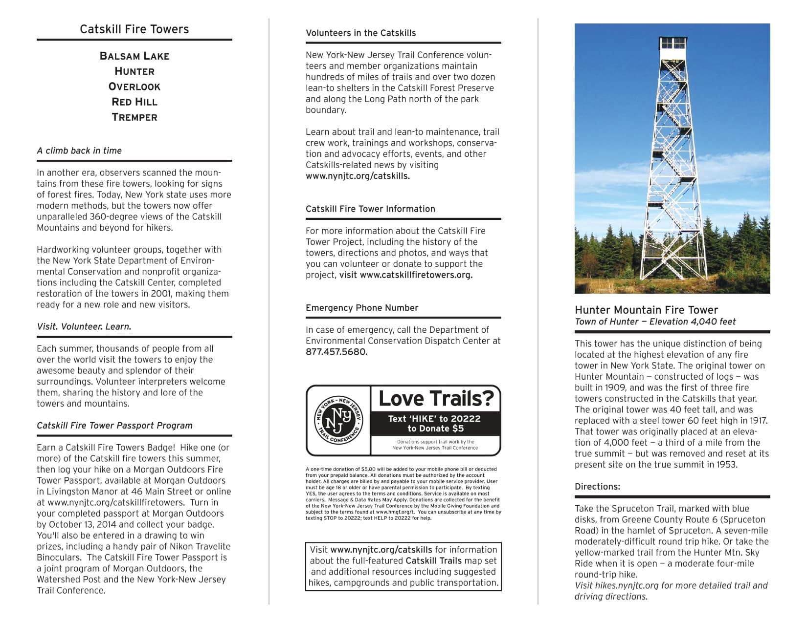
Hunter Mountain Fire Tower - Multiple access points available
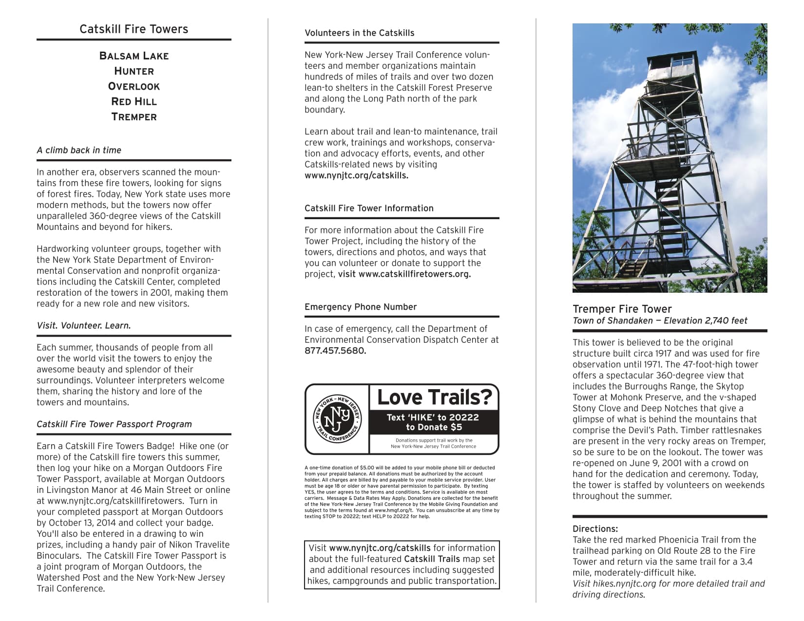
Tremper Mountain Fire Tower - Note: Timber Rattlesnakes present
Overlook Mountain Fire Tower - Highest rattlesnake population
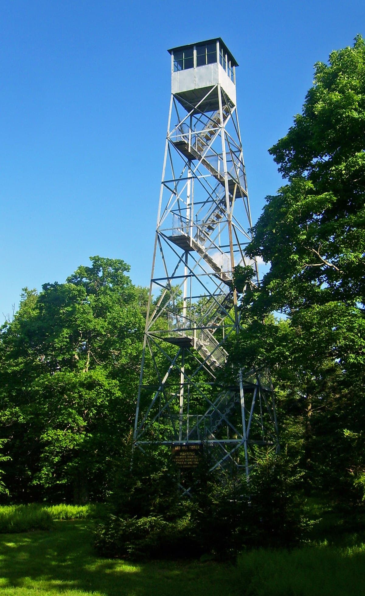
Red Hill
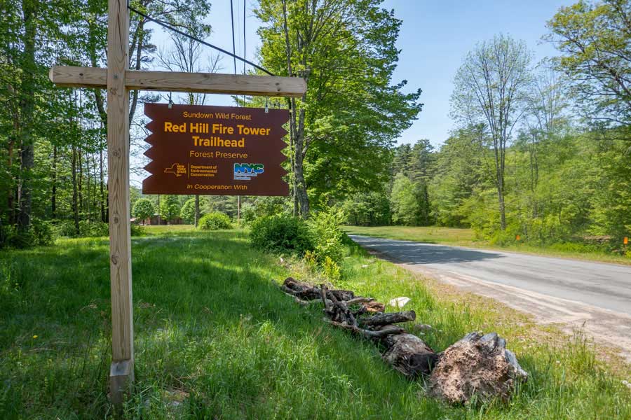
Red Hill Fire Tower - The easiest of the five towers to hike
Red Hill trail - 2.86 mile round trip with scenic views
Click map for details - 2.86 mile round trip
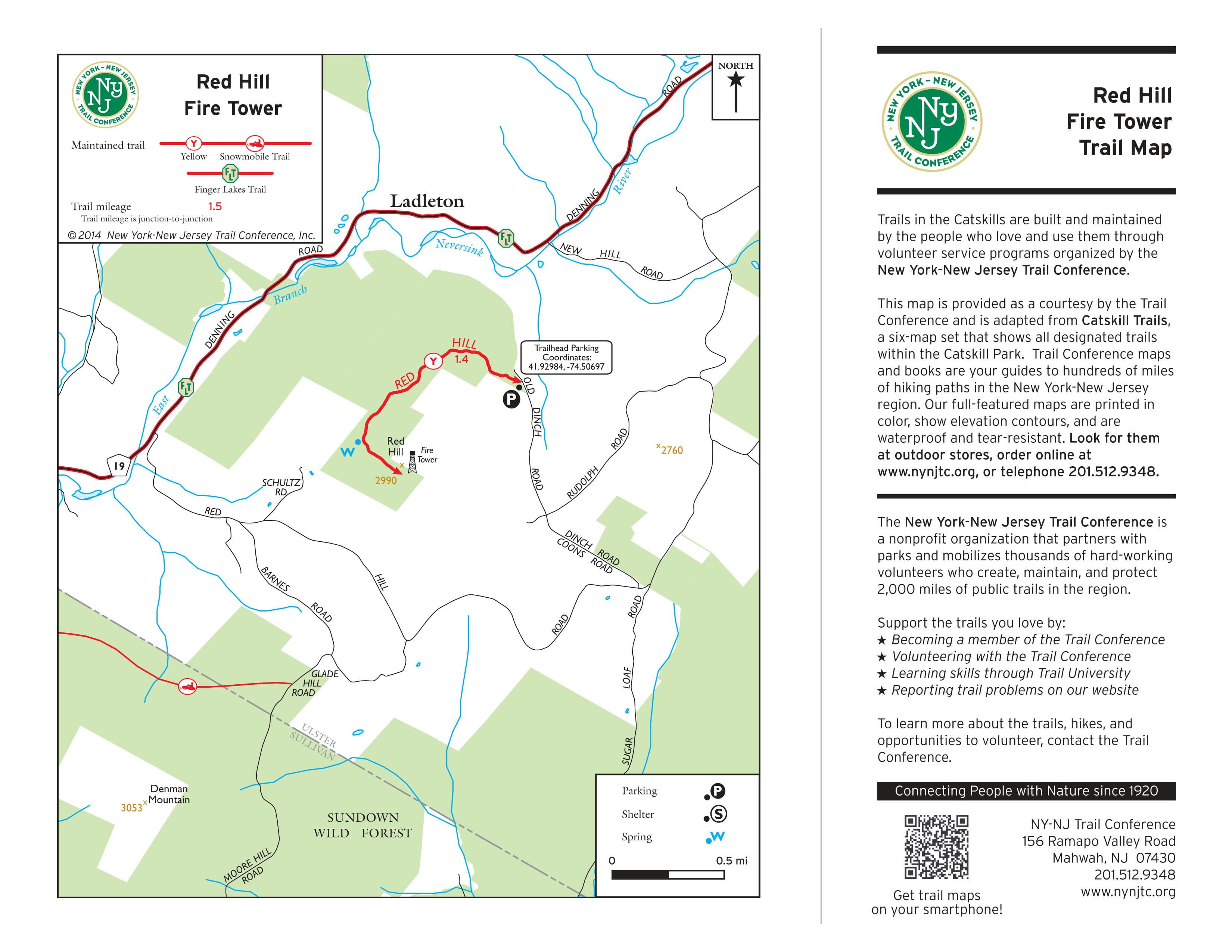
Red Hill Trail Map - Detailed topographical view showing trail routes and elevation
Red Hill Information Map - Trail details, distances, and important landmarks
Red Hill is the easiest of the five towers to hike. Because of how close it is to camp; it is even doable to drop Scouts off at the Red Hill trailhead and head over to OSR to drop off gear and do some set up before returning to pick up your Scouts.
Red Hill is the shortest of the tower trails (2.86m round trip), so if the goal is to fulfill a rank or merit badge requirement, you might want to designate a drop off/pick up point on the approach road to get the necessary mileage.
It is about a 2 ½-hour ride from Long Island to Red Hill. The route takes you past the Neversink Reservoir and an opportunity to stop and explain the engineering marvel of the New York City water system and how water gets from upstate New York to the Big Apple. One of the trails in Onteora actually crosses another one of the feeder aquaducts to the city.
From Red Hill, it is about a 40-minute drive to OSR.
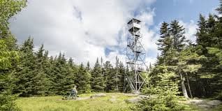
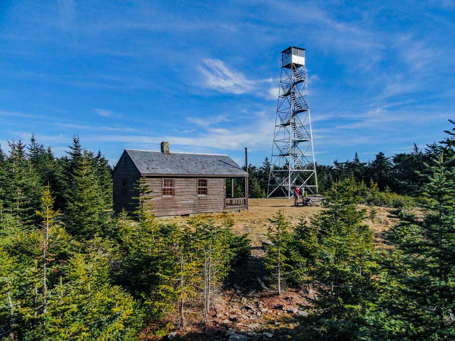
Balsam Mountain
Balsam Mountain Fire Tower - 3-mile hike to the tower
Balsam Mountain trail - Beautiful scenic views along the way
Lean-to and camping area available for overnight stays
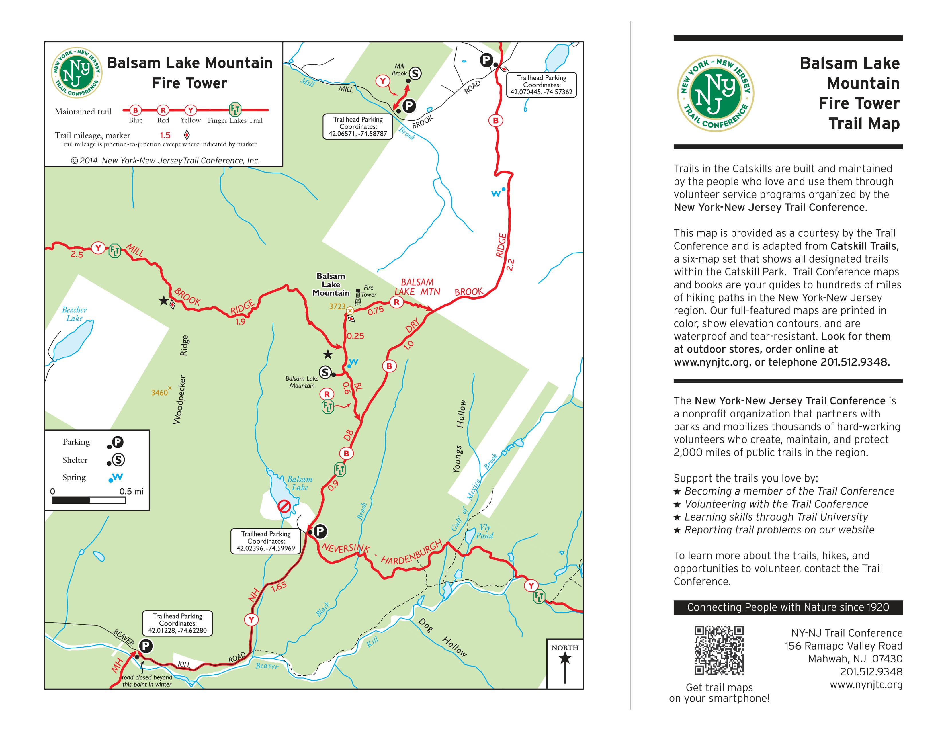
Balsam Mountain Trail Map - Detailed topographical view showing trail routes and elevation
Balsam Mountain Information Map - Trail details, distances, and important landmarks
It is a 3-mile hike to the tower and the Ranger's house, which is often staffed by volunteers on weekends. There are two routes, one a little steeper than the other, but both manageable.
There's a nice relaxing area for lunch and if you have scouts who need to spend a night on the trail for a merit badge, there is a lean-to and area for tents.
Because the rest of the fire towers are further from Onteora, if those driving do not intend to hike, they should come prepared to relax and wait because going back and forth to OSR would likely be impractical. (The driving times on the maps below are for the entire trip from LI to OSR. Subtract 2.5 hours to calculate the trip from a fire tower parking lot to OSR)
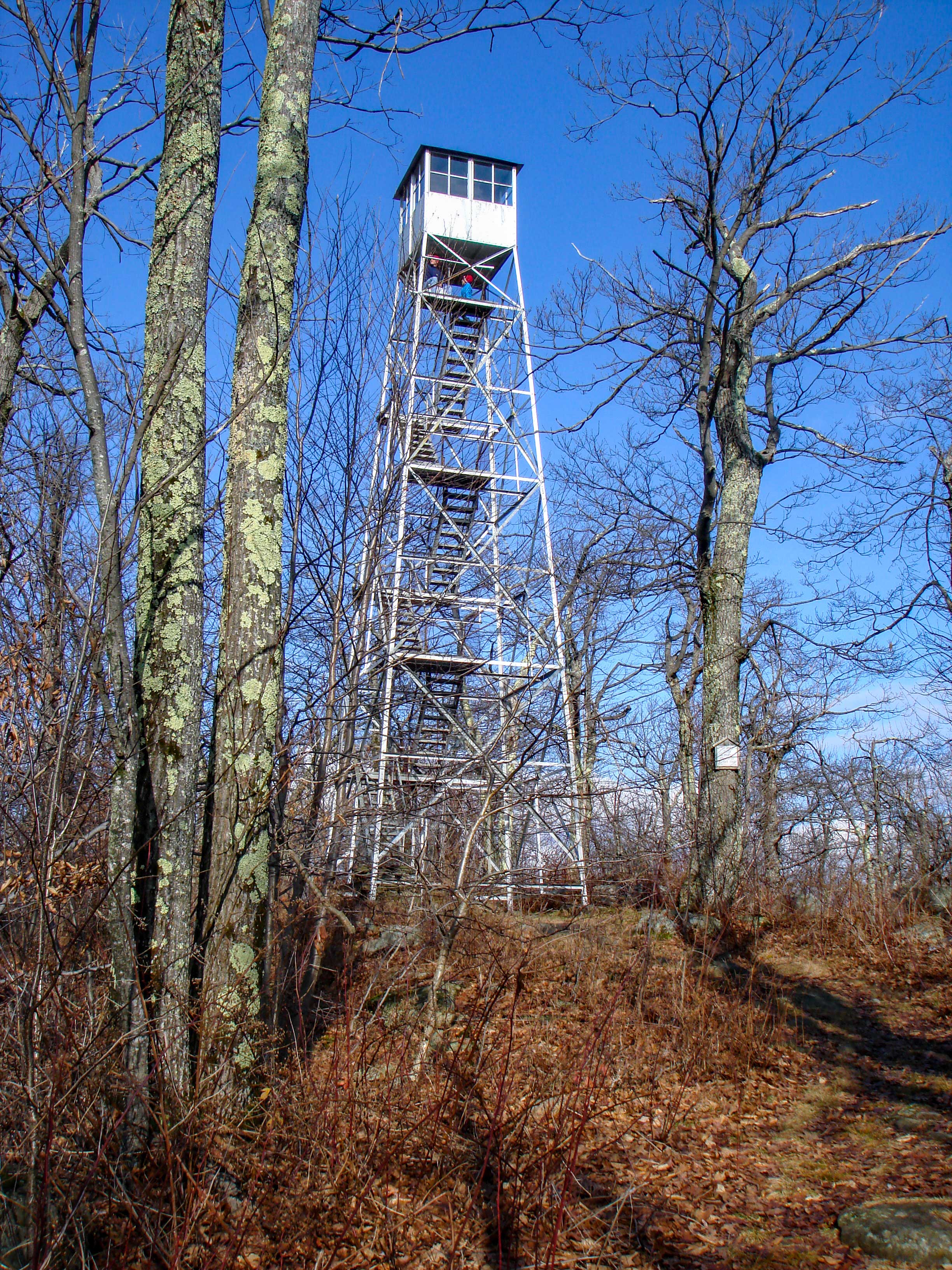
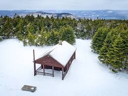
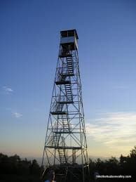
Hunter Mountain
Hunter Mountain Fire Tower - Multiple access points available
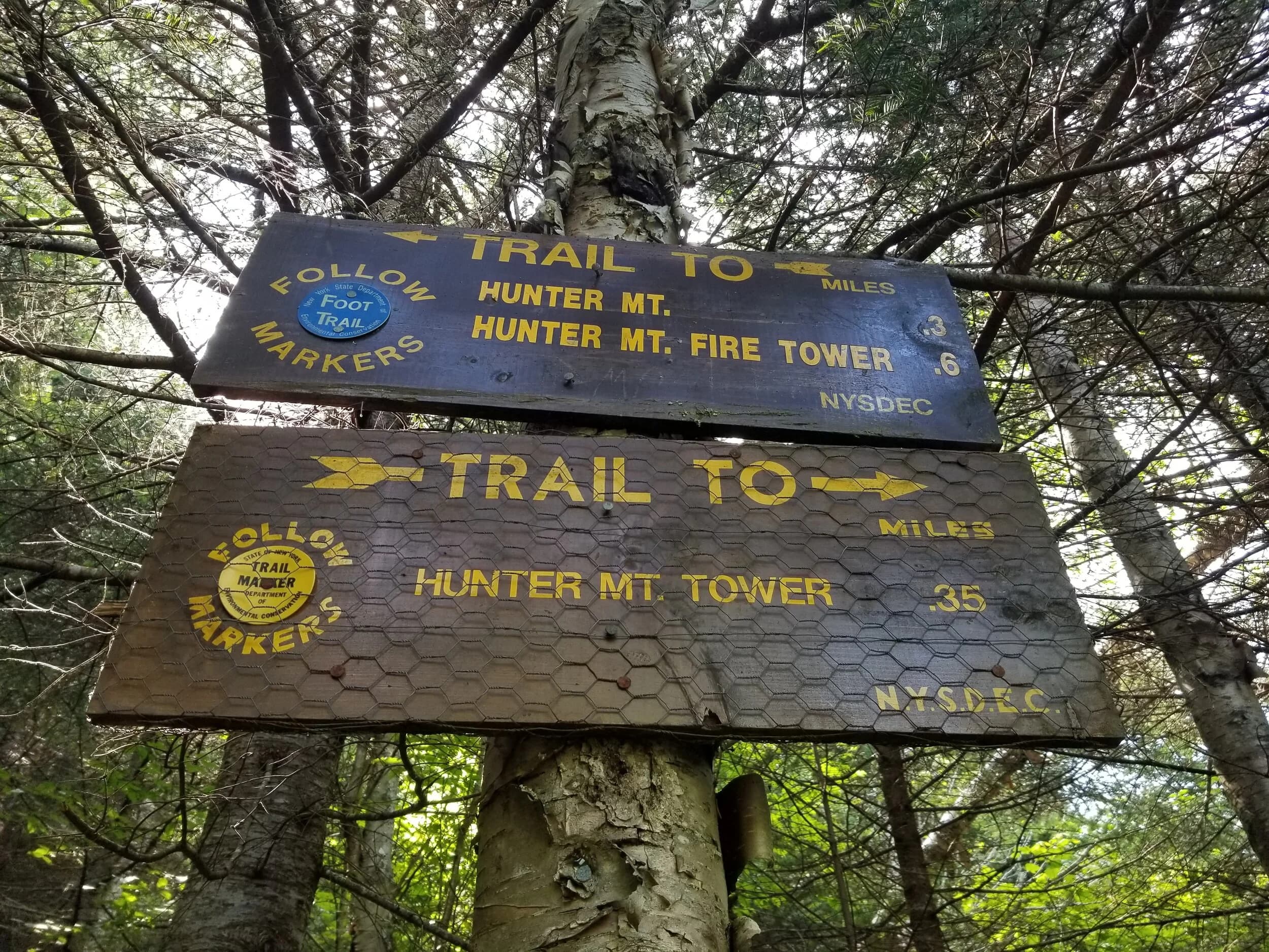
8-mile loop trail with options to shorten to 6.26 miles
Multiple access points - plan ahead as lots fill early
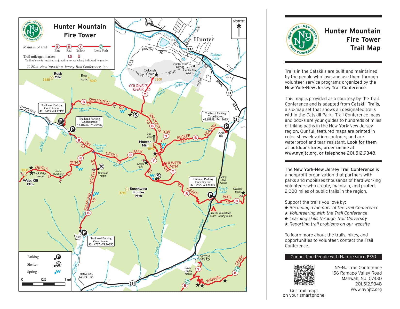
Hunter Mountain Trail Map - Detailed topographical view showing trail routes and elevation
Hunter Mountain Information Map - Trail details, distances, and important landmarks
CLICK FOR LINK
There are multiple spots from which you can access the fire tower loop trail, so plan ahead and leave early, as the lots fill early on weekends. If you want to shorten the full 8-mile hike, you can skip the loop and use the jeep trail and trim the hike to 6.26 miles.
The two accesses from the East side requires a steep climb. The access from the Diamond Notch access side is rocky climb.
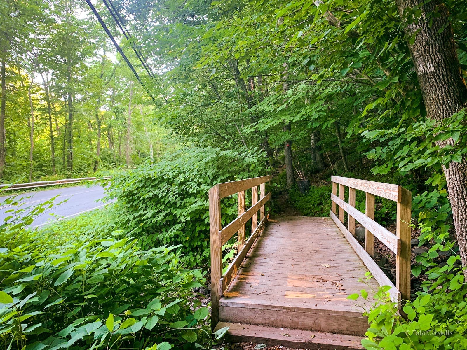
Tremper Mountain
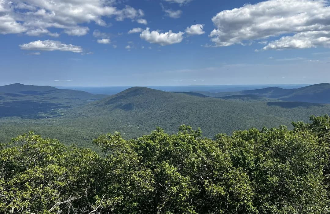
Tremper Mountain Fire Tower - Note: Timber Rattlesnakes present
Important: Rattlesnake den located near the trail
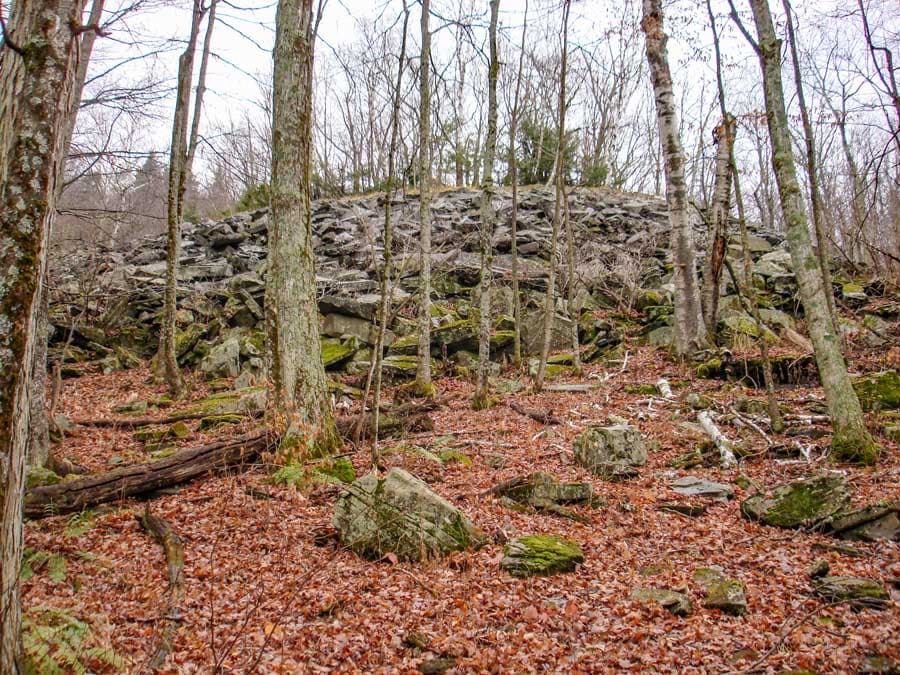
Old blue stone quarry area - exercise extreme caution
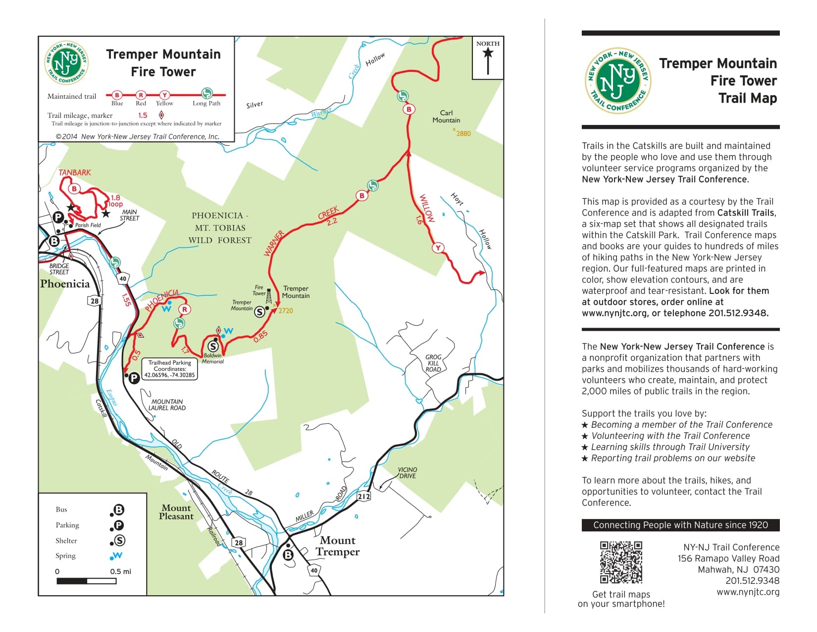
Tremper Mountain Trail Map - Detailed topographical view showing trail routes and elevation
Tremper Mountain Information Map - Trail details, distances, and important landmarks
⚠️ WARNING: There are Timber Rattlesnakes on Tremper Mountain. There is a Rattlesnake den about 100 feet off the trail in the old blue stone quarry at elevation 1,450' (on trail - actual quarry is around 1,500'). It has been reported that there are approximately 100 Timber Rattlesnakes that den at the old blue stone quarry on Mount Tremper.
There is an old road that leads into the quarry. Pickup up rocks in the quarry is an easy way to get bit. Rattlesnakes will come down and sit on the side of the trail, or even in the trail. They can be found anywhere on the mountain from Spring until late Fall. But, most are found around 1,450'. Before you do this hike, you should become knowledgeable about Rattlesnakes.
Overlook Mountain
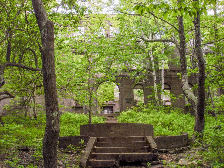
Overlook Mountain Fire Tower - Highest rattlesnake population
Hotel ruins area - Exercise extreme caution with rattlesnakes
Echo Lake area - Rattlesnakes and Black Bears present
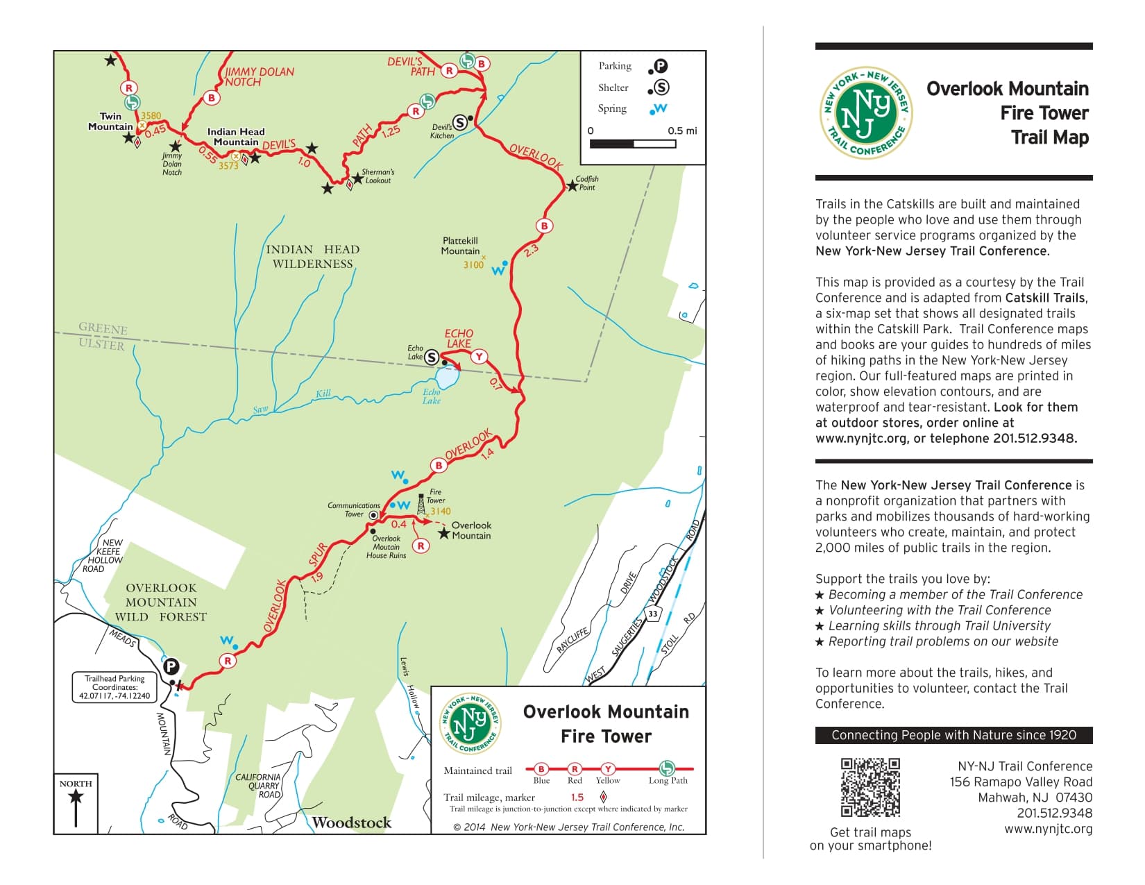
Overlook Mountain Trail Map - Detailed topographical view showing trail routes and elevation
Overlook Mountain Information Map - Trail details, distances, and important landmarks
⚠️ WARNING: This hike has the highest population of Timber Rattlesnakes in the Catskill Mountains. They can be found anywhere from the Parking Lots to the summit of Overlook Mtn, and Echo Lake. The road to the summit of Overlook Mtn is very wide, so it is easy to avoid them.
While very few people see them from the Parking Lot to the Hotel ruins, they do show up there once-in-a-while. From the Hotel ruins up to the Overlook Mountain Summit (fire tower) there are a LOT of Timber Rattlesnakes. Be careful walking around the hotel ruins. They are often seen outside AND inside the hotel ruins. Stay out of grassy areas! Stay on the trail. Do not walk on the edge of the road anywhere on this hike. The road is very wide, so it is easy to stay away from the edge of the road.
There are Timber Rattlesnakes around Echo Lake. Probably not as many as on the peak of Overlook Mountain. There are Black Bears around Echo Lake.
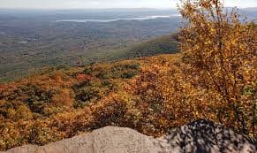
Gertrude's Nose Trail
Gertrude's Nose Trail - 6.9 mile loop in Minnewaska State Park
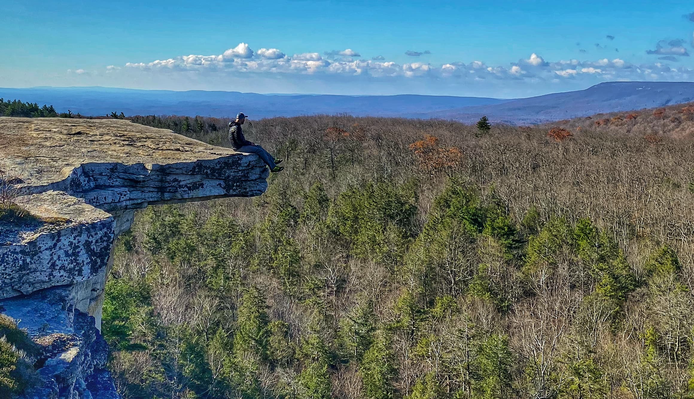
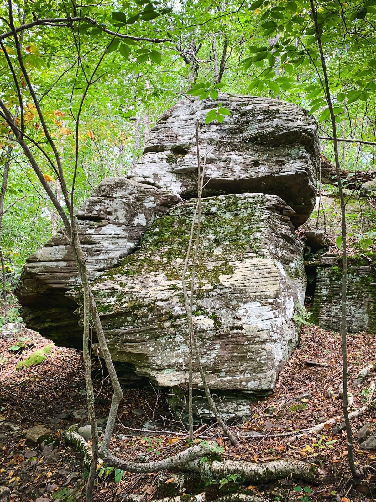
Spectacular rock outcroppings and breathtaking views
Beautiful scenic views from the trail
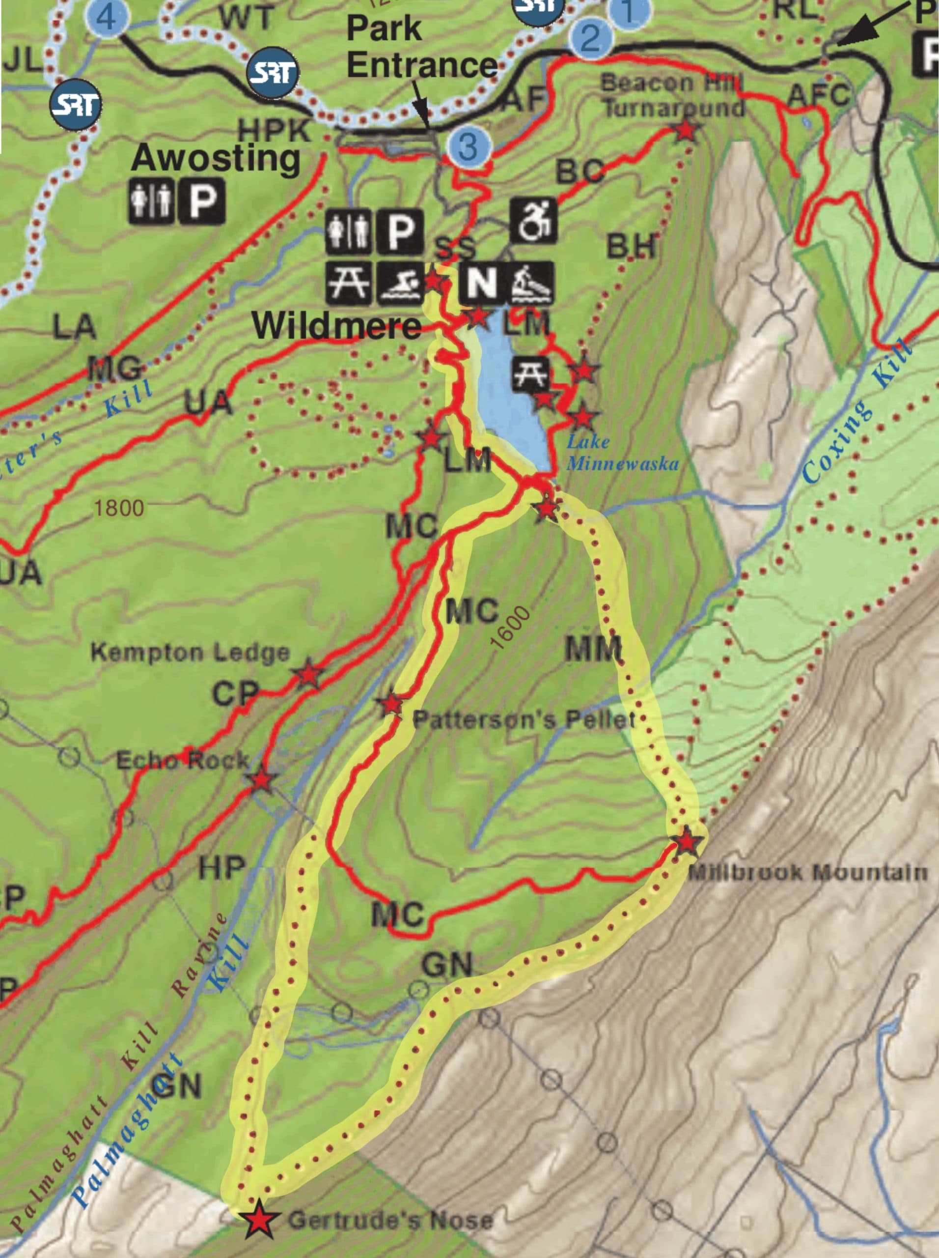
Trail Map - Clockwise loop best used April to October
While the main purpose of this collection is to exploring the fire towers, there are countless opportunities to explore other parks on the way to Onteora. One of the main options is to continue north on the NYS Thruway instead of getting on to Route 17, and visiting a state park further north. Then head over to OSR.
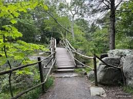
Gertrude's Nose Trail is a 6.9 mile heavily trafficked loop trail located near High Falls that features a lake and is rated as moderate. The trailhead clockwise--is primarily used for hiking and is best used from April until October. The views from the south and east are breathtaking. Additionally, the rock outcroppings are truly spectacular. Allow for plenty of time to enjoy the views and pack enough water.
Trail Map
New York State campgrounds in the area:

Beautiful camping opportunities throughout the Catskill region
Little Pond Campground

Little Pond Campground - Scenic camping in the Catskills
Reservations
Mongaup Pond Campground

Mongaup Pond Campground - Beautiful lakeside camping
Reservations
Catskill Park Listing of NYS Campgrounds & Day Use Areas
- Bear Spring Mountain Campground & Day Use Area
- Beaverkill Campground & Day Use Area
- Devil's Tombstone Campground & Day Use Area
- Kenneth L. Wilson Campground & Day Use Area
- Little Pond Campground & Day Use Area
- Mongaup Pond Campground & Day Use Area
- North-South Lake Campground & Day Use Area
- Woodland Valley Campground & Day Use Area
For a listing of all private and state campgrounds that allow tents, go to:
CLICK FOR LINK TO WEBSITE
CLICK TO DOWNLOAD FIRE TOWER PDF
Adventure Weekends to the Catskill Fire Towers v4 with more pics.pdf